
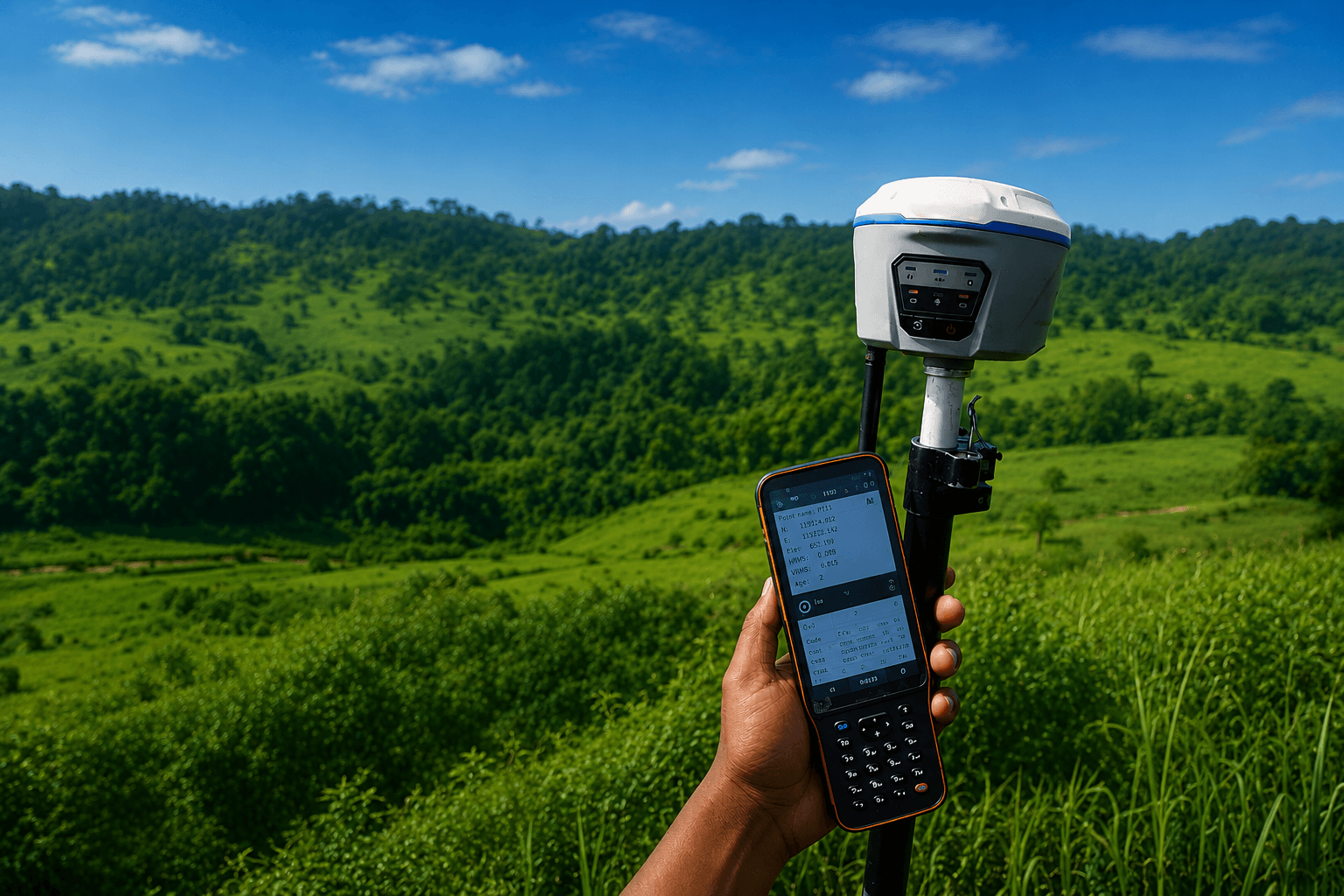
Precision Today,
Better Tomorrow
Advanced surveying solutions using the latest technology for accurate and reliable results.
Surveyed Site Photographs & Digital Deliverables
Inspect authentic high-resolution field photographs and engineering CAD datasets captured on-site by our certified surveying crews across Kerala.
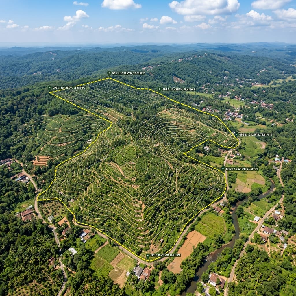
37-Acre Ancestral Plantation Estate Boundary Demarcation & Contour Survey
High-precision DGPS satellite georeferencing and electronic total station boundary verification across 37.5 acres of undulating plantation terrain. Successfully reconciled historical village revenue sketches with physical boundary pins and issued certified survey maps for estate partition.
Specialized Land Survey Services
Every survey is executed using multi-frequency satellite DGPS, 1-second total stations, and precision digital auto-levels with signed municipal certificates.
GPS & DGPS Precision Land Survey
Accuracy: ±5mm to ±10mm RTK
Sub-centimeter geodetic land mapping utilizing dual-frequency GNSS receivers and real-time kinematic (RTK) differential networks for absolute spatial accuracy.
Topographical & Contour Survey
Accuracy: ±2mm Electronic EDM / ±5mm Elevation
Comprehensive 3D site mapping capturing natural ground relief, elevation contours, trees, structures, utilities, and drainage corridors for architectural and engineering design.
Cadastral, Title & Boundary Land Survey
Accuracy: ±2mm / Cadastral Match
Official legal land surveying for property buyers, landowners, and developers to verify deed dimensions, establish true boundary corners, and prevent encroachment disputes.
Contour Survey & Slope Topography
Accuracy: ±5mm Vertical Elevation
Specialized vertical elevation surveying that produces smooth, accurate contour intervals and 3D slope models for grading, drainage routing, and structural terrace design.
Land Plot Subdivision & Masterplan Survey
Accuracy: ±2mm Plot Corner Tolerance
Comprehensive parcel partitioning and layout surveying for real estate developers and families looking to divide large land tracts into individual legally marketable plots.
Boundary Refixing & Demarcation
Accuracy: ±2mm Exact Deed Alignment
Precision re-establishment of missing, destroyed, or disputed property boundary markers using historical title records, revenue maps, and geodetic coordinate matching.
Construction Setting Out
Accuracy: ±1mm Sub-Millimeter Construction Tolerance
Sub-millimeter transfer of architectural and structural CAD drawings onto the physical construction site, marking exact grid lines, foundation piles, column axes, and datum levels.
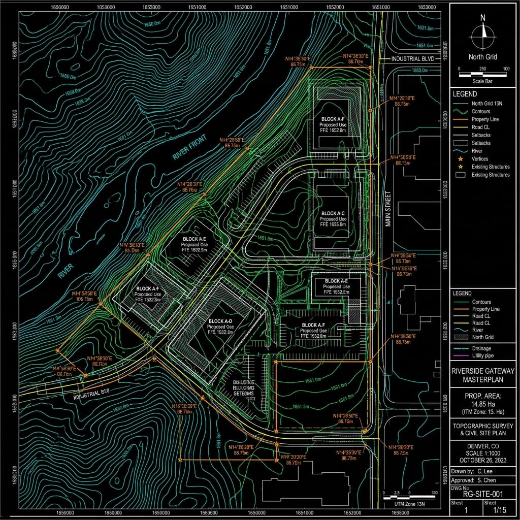
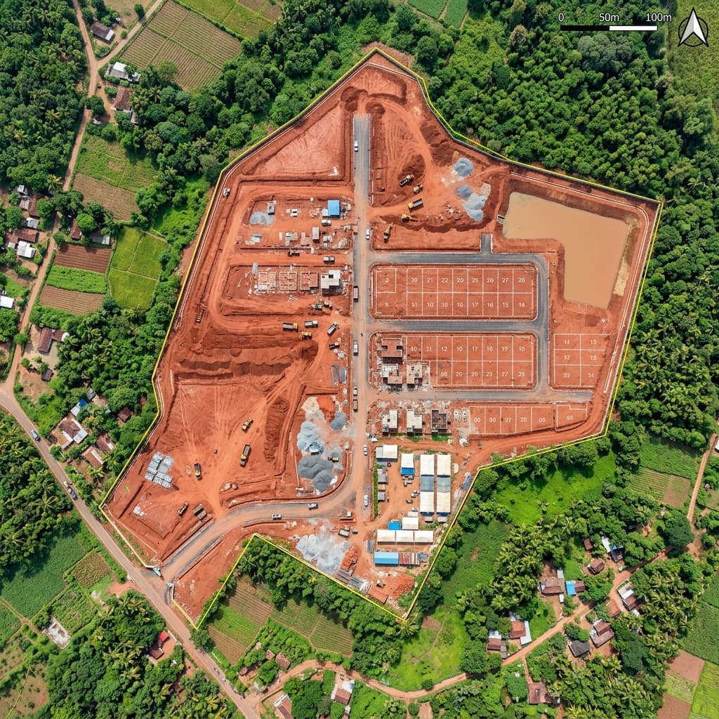
Precision Transformed: Raw Site vs. Layered CAD Deliverable
Interact with our real-world geodetic datasets: slide to inspect how field DGPS and robotic total station measurements are processed into millimeter-accurate AutoCAD .DWG, 3D contours, and boundary demarcations.
Multi-Layered .DWG / .DXF
Organized in 18+ industry CAD layers (Contours, Boundary, Setbacks, Utilities).
Legal Surveyor Stamp
Certified by licensed surveyors with verified revenue boundary reconciliation.
Sub-Centimeter RTK GNSS
Georeferenced to national geodetic datums with permanent on-ground benchmark pillars.
How We Deliver Unassailable Accuracy
From historical title deed mathematical auditing to on-site laser staking and signed CAD stamping.
Deed & Revenue Audit
We cross-reference your title deeds, village revenue sketches, and adjacent settlement records to establish historical boundary baselines.
DGPS & Laser Capture
Our licensed crew mobilizes with dual-frequency RTK GNSS and 1-second total stations to capture thousands of georeferenced spatial vectors.
CAD / Civil 3D Processing
Raw field vectors are adjusted in geodetic software to generate clean, layered AutoCAD DWG plans, 3D contours, and encroachment reports.
Featured Case Studies
37-Acre Rubber & Spices Plantation Hill Slope Topographic & Boundary Survey
Complete 3D digital terrain modeling and boundary demarcation for a 37-acre undulating rubber and spice estate in Ponkunnam to plan hillside terracing, natural drainage channels, and official family partition boundaries.
Commercial Retail & Multiplex Setting Out & Column Grid Layout
Provided continuous precision column setting out, foundation pile centers, and floor level elevation transfers for a multi-level commercial complex in the heart of Pala.
28-Acre Residential Villa Layout Subdivision & Boundary Demarcation
Complete boundary reconciliation with historical village revenue records, internal 9-meter road network design, and physical concrete monumentation for 110 premium residential villa plots.
15-Acre Mixed-Use Commercial Estate DGPS & Contour Survey
Comprehensive 15-acre DGPS land boundary demarcation and 3D contour topographic survey covering natural terrain levels, boundary verification with revenue sketches, and civil engineering site plan preparation.
Service Areas & Local Survey Crews
Active field teams deployed across major hubs with 24-hr on-site mobilization.
Trusted by Leading Architects & Developers
“Odyssey Survey is our trusted surveying partner across Kottayam and central Kerala. Their 3D contour terrain models and layered CAD drawings integrate directly into Autodesk Revit, allowing our team to design foundations for undulating hill slopes in Pala with complete confidence.”
“Whenever my clients face land boundary disputes or compound wall encroachments in Pathanamthitta or Thiruvalla, Odyssey Survey is the only firm I recommend. Their mathematical reconciliation with historical village revenue records provides court-admissible clarity that settles disputes peacefully.”
“Before dividing our ancestral 30-acre property in Ponkunnam into family shares, we hired Odyssey for a DGPS boundary and topographic survey. Their team was on-site within 24 hours, pegged every plot corner with concrete markers, and provided flawless municipal partition drawings.”
Frequently Asked Questions
Everything you need to know about precision land surveying, municipal clearances, and turnaround times.
Ready to Verify Your Land with Millimeter Precision?
Speak directly with our senior geodetic surveyor. Get a rapid technical assessment and 24-hr on-site mobilization.